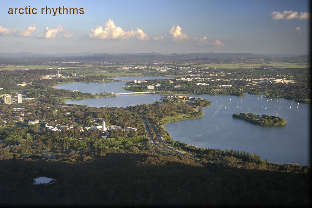
Canberra, from Black Mountain
This is the view looking southeast from Black Mountain toward Parliamentary Triangle and Lake Burley Griffin. Lake Burley Griffin was named for the Chicago architect, Walter Burley Griffin, who won the design competition for the city of Canberra. His wife, Marion Mahony Griffin, was also a major participant in the winning design. Construction of Canberra began in 1913; the lake was created in 1963 from the Molonglo River by the Scrivener Dam, which is located off this picture to the right.
The West Basin is everything below the nearest bridge, Commonwealth Avenue Bridge. The sailboats in the picture are in the West Basin, and the West Basin also includes the water directly to the left of them on the other side of the peninsula that juts up from the near shore (Acton Peninsula). Just above Commonwealth Avenue Bridge is the Central Basin (35°17′42.78″S, 149°08′09.95″E) (Google Maps) which continues until you reach the upper bridge, Kings Avenue Bridge. The last bit of water at the top is the East Basin.
The two bridges form two sides of a triangle whose apex is the new Parliament House, which is the large white building found to the far right edge of the picture, just in from the trees and above the right half of the sailboats. The base of the triangle runs roughly vertically in the picture, to the left of the lake, and is marked by Constitution Avenue. This is Parliamentary Triangle, and contains the seat of government and many significant national buildings.
If you look to the far left shore of the Central Basin, you'll see a stretch of shore which is brick colored. Four of the next five shots were taken from near there.